The Historic Landscape Character Areas (HLCAs)
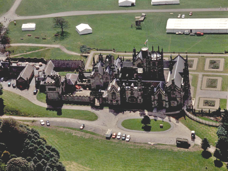
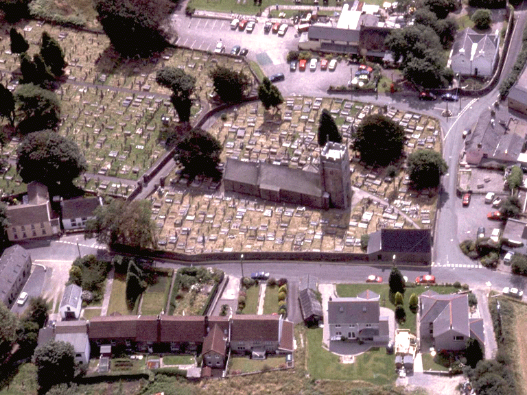
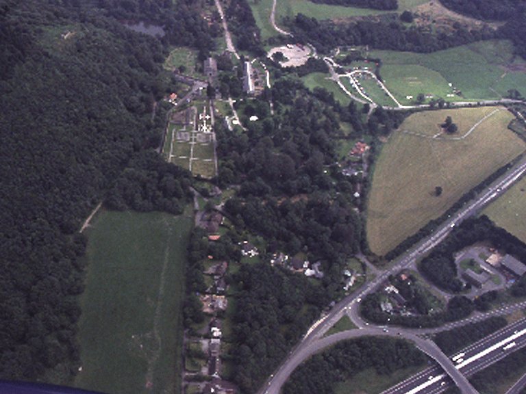
HLCA 001 Margam Abbey and Castle
Significant early medieval/medieval ecclesiastic and monastic centre with church and cemetery; important early medieval ecclesiastic/secular settlement and administrative focus; important and influential post-medieval gentry estate and deer park; registered parkland and gardens; post-medieval vernacular and other notable buildings; important relict multi-period/multi-functional archaeological landscape; buried archaeology includes cropmarks and find scatters; Ancient and other broadleafed woodland and plantation; important historic associations. Back to Map
Click here for further information about this Historic Landscape Character Area
Click here for a character area map
HLCA 002 Cefn Crugwyllt and Cwm Maelwg
Enclosed agricultural landscape with historic monastic associations and relict medieval settlement features; Ancient and other woodland; post-medieval vernacular buildings. Back to Map
Click here for further information about this Historic Landscape Character Area
Click here for character area map
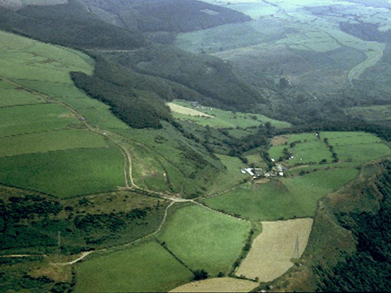
HLCA 003 Cwm Brombil and Graig Fawr
Steep west-facing hillside and deeply entrenched side valleys; mixed area of Ancient and other woodland and medieval/post-medieval agricultural enclosure developed from earlier valley core; multi-period relict landscape. Back to Map
Click here for further information about this Historic Landscape Character Area
Click here for character area map
HLCA 004 Mynydd Brombil and Ergyd Isaf
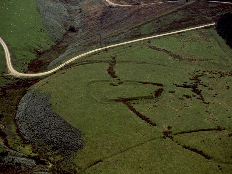
Enclosed upland, primarily post-medieval enclosure; deserted medieval/post-medieval upland settlement landscape with relict prehistoric funerary and ritual features. Back to Map
Click here for further information about this Historic Landscape Character Area
Click here for character area map
HLCA 005 Llangynwyd
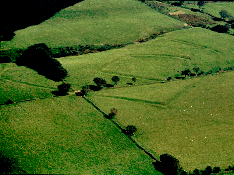
Important diverse multi-period relict archaeological landscape, including: pre-historic and medieval settlement with associated field systems; prehistoric enclosures (upland agricultural landscape features); medieval military/defensive feature; post-medieval vernacular buildings; important well-documented historic associations; small, but important nucleated settlement with medieval (or earlier) origins, centred on medieval church and cemetery; dispersed scatter of settlement throughout the surrounding area; Ancient woodland. Back to Map
Click here for further information about this Historic Landscape Character Area
Click here for character area map
HLCA 006 Eglwys Nunydd and Cwrt-y-defaid
Agricultural and residential area with important historic associations; important ecclesiastic landscape with early origins; post-medieval fieldscape; relict archaeological landscape of early medieval/medieval/post-medieval settlement; interesting post-medieval vernacular buildings; buried archaeological remains in the form of finds (including medieval inscribed stones) and parch/crop marks; important communication corridor (Roman and later) . Back to Map
Click here for further information about this Historic Landscape Character Area
Click here for character area map
HLCA 007 Graig Goch and Heol Newydd
An agricultural landscape of small evolved/irregular fields; scatter of post-medieval farmsteads and cottages. Back to Map
Click here for further information about this Historic Landscape Character Area
Click here for character area map
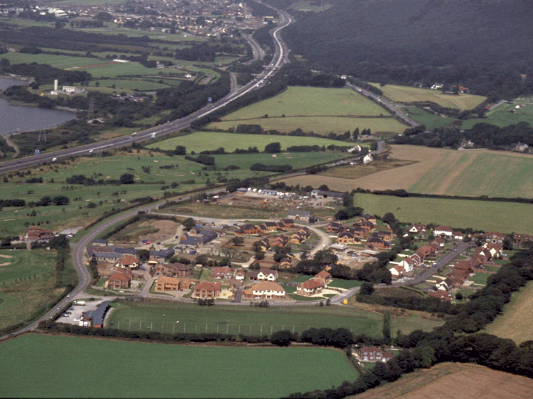
HLCA 008 Margam Village
Post-medieval estate village with 20th century ribbon addition; post-medieval (17th-19th century) vernacular buildings and 20th century suburban residences. Back to Map
Click here for further information about this Historic Landscape Character Area
Click here for character area map
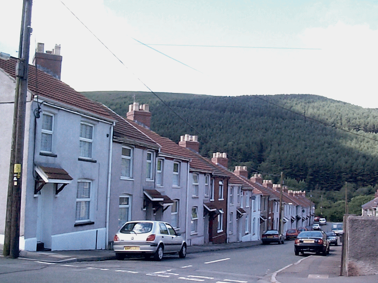
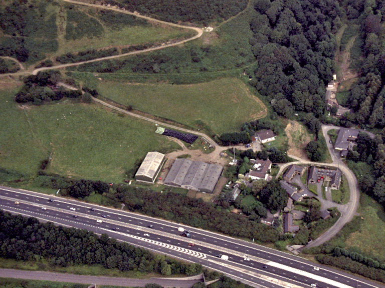
HLCA 009 Cwm Dyffryn and Cwm Farteg Railway Corridor
Industrial/public railway/tramroad corridor; industrial railside settlement (terraced housing and large cemetery); former agri-industrial function. Back to Map
Click here for further information about this Historic Landscape Character Area
Click here for character area map
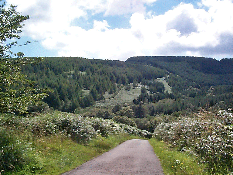
HLCA 010 Mynydd Margam Forest
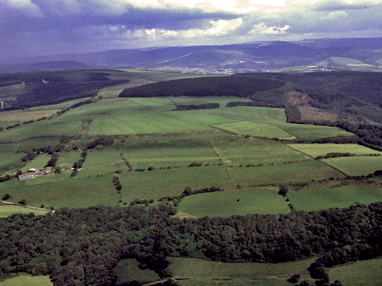
Extensive 20th century forestry plantation (Ancient and other broadleafed woodland); formerly open mountain and enclosed land; former monastic land: grange and chapel; relict multi-period archaeological landscape: prehistoric, medieval, and post-medieval settlement (loose dispersed settlement pattern) and fields, prehistoric funerary and ritual with a prehistoric defensive element; prehistoric, medieval and post-medieval communications corridor; accumulation of blanket peat with environmental potential; industrial archaeological features. Back to Map
Click here for further information about this Historic Landscape Character Area
Click here for a character area map
HLCA 011 Waun-y-Gilfach
20th century forestry plantation; former unenclosed 'Waun'; footpaths and tracks. Back to Map
Click here for further information about this Historic Landscape Character Area
Click here for character area map
HLCA 012 Nant y Gadlys and Nant Bryncynan
Ancient and other broadleafed woodland; medieval/post-medieval agricultural settlement/fields; post-medieval vernacular buildings; industrial (milling) archaeology. Back to Map
Click here for further information about this Historic Landscape Character Area
Click here for character area map
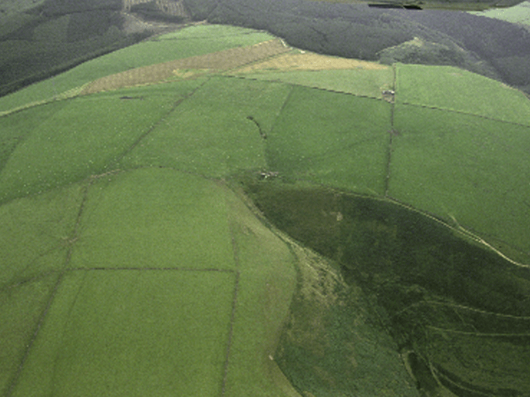
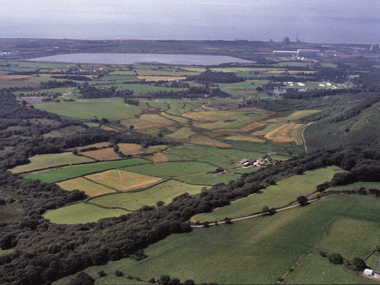
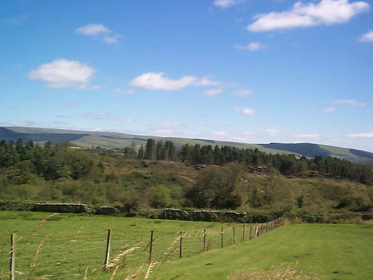
HLCA 013 Upper Cwm Kenfig
Multi-period and multi-functional upland landscape with important relict archaeology: prehistoric and medieval settlement/fields, prehistoric funerary and ritual landscape, prehistoric enclosures (upland agricultural landscape features); accumulation of blanket peat with environmental potential; important prehistoric and medieval communication corridor. Back to Map
Click here for further information about this Historic Landscape Character Area
Click here for character area map

HLCA 014 Moel Ton Mawr
20th century forestry plantation on former open unenclosed mountain; similar to HLCA 010; relict archaeology: funerary and ritual; communication features; accumulation of blanket peat with environmental potential. Back to Map
Click here for further information about this Historic Landscape Character Area
Click here for character area map
HLCA 015 Upper Park and Ton-y-grugos
Enclosed upland grazing: large regular enclosures; distinctive field boundaries; relict archaeology: prehistoric, medieval and post-medieval settlement/fields; prehistoric enclosures (upland agricultural landscape features); buried archaeology: parchmark. Back to Map
Click here for further information about this Historic Landscape Character Area
Click here for character area map
HLCA 016 Ton Mawr
Enclosed agricultural landscape with possible medieval (or earlier origins); post-medieval settlement/fields; distinctive field boundaries; Ancient Woodland; footpaths and tracks. Back to Map
Click here for further information about this Historic Landscape Character Area
Click here for character area map
HLCA 017 Cwm Dyffryn: Southern Valley Sides
Post-medieval settlement/fields; varied field pattern and distinctive field boundaries; settlement pattern: dispersed and minor ribbon development; minor communications. Back to Map
Click here for further information about this Historic Landscape Character Area
Click here for character area map