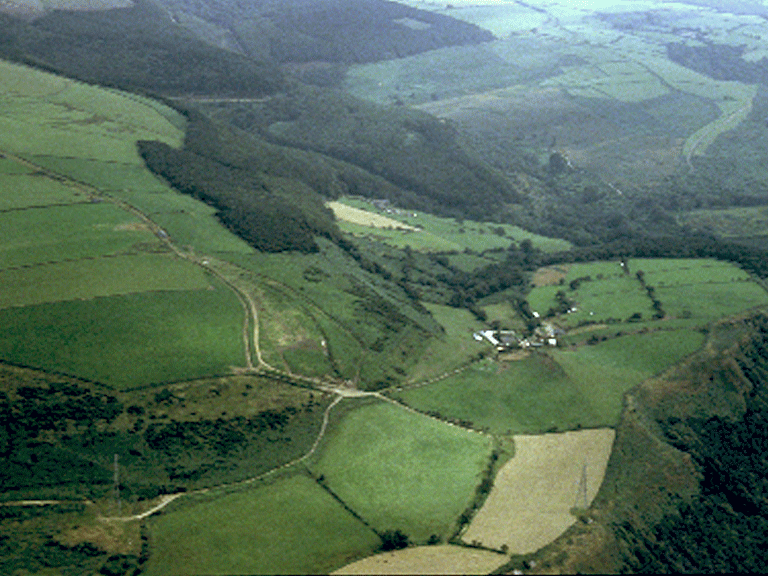
Margam Mountain
002 Cefn Crugwyllt and Cwm Maelwg

HLCA 002 Cefn Crugwyllt and Cwm Maelwg
Enclosed agricultural landscape with historic monastic associations and relict medieval settlement features; Ancient and other woodland; post-medieval vernacular buildings. Back to Map
Historic Background
The historic landscape area of Cefn Crugwyllt and Cwm Maelwg is an area associated with the medieval abbey of Margam, specifically the grange of Cryke, identified with the farmstead of Grugwallt (Crugwyllt fawr) by Gray, however no remains of the period are visible at Crugwyllt fawr today. Margam is known to have held land at 'Crikfeld' in 1291 and the Crown Sale of 1543 included lands in 'Cryke' and the site of a water mill called 'Cryke Mylle' (within the adjacent HLCA 001). A 'bath' or holy well within a small rectangular structure is located (8030 8692) to the east of Crugwyllt fawr within Cwmbach (RCAHMW, 1982, 275-6; Williams, 1990, 48-52).
Following the dissolution of the monasteries, the area, along with other former possessions of the Abbey, was purchased at the Crown Sale of 1543 by Sir Rice Mansel, and remained in his successor's hands until the break up of the estate during the Second World War. Hill Estate maps (1814) show that the field pattern of the area was fully established by the start of the 19th century.
Historic Landscape Characteristics
Cefn Crugwyllt and Cwm Maelwg is an area, which is characterised as an enclosed agricultural landscape with medieval/post-medieval settlement/fields and varied enclosures with distinctive boundaries including drystone wall, stone-faced banks and stone-faced banks with hedges. Documentary evidence indicates the area, set on an upland spur/ridge location, was formerly part of a medieval monastic grange belonging to the adjacent Cistercian Abbey of Margam. A prominent surviving monastic feature is the 'Bath House' or 'Bath' Holy Well (PRNs 00754w and 04796w; SAM Gm 545) of 14th or `15th century date.
Most of the post-medieval vernacular buildings within the area are in an altered condition, though an interesting example of a Renaissance central stair-passage house remains at Cwm Maelog. Aerial photographic material indicates possible buried archaeology in the area represented by parch marks. The southern and northern edges of the area are characterised by remnant Ancient woodland augmented by later plantation and 20th century forestry. Other characteristics include minor communication features, such as the medieval trackway on Cefn Crugwyllt.