Background
Between 2004 and 2010, the Glamorgan-Gwent Archaeological Trust (GGAT) carried out a project, with grant aid from Cadw, to study the industrial landscapes of the northern coalfield rim, specifically the Heads of the Valleys area, associated with the coke-fired iron industry, perhaps the most influential of industries in the history of south Wales.
The project encompassed the ironworks themselves and related features, associated transport networks, water management, and extractive features. The aim of the project was to raise the level of data on, and hence the profile and understanding of, this heritage resource, and ultimately aid preservation through proactive management, for example informing the Heads of the Valleys Initiative.
The project involved the identification, quantification, mapping, and description of industrial landscapes and features. The survival and condition of the resource was assessed, potential threats were identified, and current levels of protection reviewed.
The project involved the compilation and review of existing information, including records held at:
- Heritage Environment Record at Glamorgan-Gwent Archaeological Trust (GGAT), Swansea
- National Monuments Record of the Royal Commission on Ancient and Historical Monuments in Wales (RCAHMW), Aberystwyth
- Cadw (for information on statutory preservation)
Key sources included The South Wales Iron Industry 1750-1885 (Ince 1993) and Early Limestone Railways (van Laun 2001). Both National and Regional Archives were consulted, primarily for historic map sources, e.g. the National Library of Wales kindly provided copies of relevant Tithe maps, estate and industrial plans. Aerial photographs were viewed at the Central Registry for Aerial Photography in Wales. Recent and historical Ordnance Survey digital mapping (1st-3rd edition OS maps), as well as digital aerial photographs, were provided under licence by the Welsh Assembly Government.
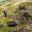
Cartographic analysis, and field survey formed a major element of the project.


