Gower
011 Llangennith

HLCA011 Llangennith
Post-medieval/medieval settlement and agricultural landscape: varied fieldscape; post-medieval vernacular buildings; ecclesiastical centre; medieval priory; scattered prehistoric features; rural industry; historic associations. Back to Map
Historic Background
The historic landscape area of Llangennith roughly equates to the medieval Manors of Llangennith West Town and Priors Town, excluding areas of common land and the reclaimed land of Llangennith Moor to the west and the enclosed land of Kennexstone and Tankeylake to the east. The area of Llangennith (Llangenydd) was located within the Welsh medieval Cwmwd of Gwyr, within the Cantref of Eginog. During the reorganization of the post-medieval period the area formed part of the Hundred of Swansea, within the County of Glamorgan.
The medieval church of Saints Mary and Cennydd, which retains fabric from the twelfth-fourteenth centuries, was founded during the early medieval period, and dedicated to the 6th century St Cennydd. An Early Christian monument (00059w), probably part of a shaft of a ninth century cross, is preserved in the church (RCAHMW 1976c, 46 no 905). The churchyard is partly curvilinear, an indication of an early foundation. The church appears to have been the site of a clas church, which had reputedly been destroyed by Viking raiders in 986 AD. In the early 12th century the church, formerly occupied by a hermit, a certain Caradog was granted to the Abbey of St. Taurinus at Evreux in Normandy by Henry de Beaumont (Bellomont), Earl of Warwick. Shortly after a small dependant Benedictine priory cell was established that was separate and distinct from the church (Orrin 1979, 40). Partly as a result of the end of the Glyndwr rebellion the priory was temporarily granted in 1406 to Ewenni priory, though following the Crown's seizure of alien priories in 1414, it was granted to All Souls' College, Oxford, between 1440 and 1442 (Glamorgan County History Vol III, 149-150; Williams 1949). In 1838, the interest of All Soul's College was transferred by Act of Parliament to Thomas Penrice, Esq, of Kilvrough.
The position of the monastic buildings has not been established; it is probable that they lay to the south, where the adjoining property retains the name of College Farm/House, and were connected to the church by a blocked south door, although Orrin (1979, 42), suggest that the blocked archway in the east wall of the tower marks a junction with a former cloister. Merrick (ed James 1983, 118) recorded in 1578 that the church was dedicated jointly to Our Lady and St Cennydd. The church was restored during the nineteenth century; the main restoration of the church was to the design of JB Fowler in 1881-4, the contractors being Messrs Rosser of Reynoldston. The tower was repaired, the nave floor was raised about 1.2 metres, monuments were repositioned, new windows inserted, and the roofs rebuilt (Newman 1995, 384; Orrin 1979, 43; Evans 1998). The settlement of Llangennith, or Prior's Town, acted as a parochial centre during the post-medieval period, for an extensive parish covering an area of approximately 1329 acres (Carlisle 1811).
Antiquarian reference mentions a small rectangular building called the Temple (00061w) located close to the Husk and an old lane leading to Llangenydd village considered to 'have been a medieval chapel of ease or a cell of the Knights Templars' (Evans 2004).
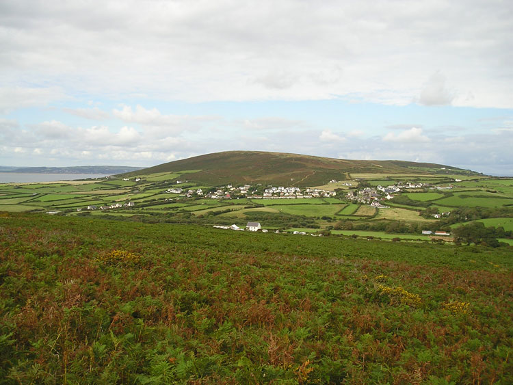
The first edition 25-inch OS map shows a small, nucleated settlement core located close to the boundary of the associated common. The settlement comprised the church within its graveyard and the adjacent 'college' to the south, and a short linear arrangement of cottages to either end of the former 'Welcome to Town' Public House located across from the church, south of the lane to West Town. North of the lane are Town House and its range of out buildings to the southeast of the village 'Pound' and the King's Head Public House. Separated by fields to the west is the scatter of cottages and farms, which comprise West Town, loosely centred on the cross roads at Plenty Farm. This settlement, which had its own separate pound, a Weslyan Methodist Chapel (9624 Zion Calvanistic Methodist Chapel), well (Bullen's Well) and a smithy, was similarly located in close proximity to the boundary of the common (25" Ordnance Survey sheet XXI-11 Surveyed 1878). Communication routes radiate from the settlement core at Priors Town and West Town, with routes accessing the common to north and east respectively.
A further settlement, now deserted was located at Coety Green (01860w) adjacent to Barraston Hall Farm. The buildings, constructed from conglomerate and red sandstone display the following architectural features: splayed windows with both stone and wooden lintels, a fireplace in a gable wall and a small oven. The RCAHMW suggests a post-medieval date for the site, but structures may be of medieval origin. According to tradition, Coety Green was abandoned in the seventeenth century as a result of plague contracted from the water supply, although documentary evidence indicates it may not have been abandoned until mid-nineteenth century.