Gower
086 Bishopston
HLCA086 Bishopston
Post-medieval/medieval settlement and agricultural landscape: nucleated settlement; post-medieval vernacular buildings; varied, formerly more regular enclosed fieldscape and road network; early medieval/medieval ecclesiastic association; rural industry - extraction/processing; and buried archaeology. Back to Map
Historic Background
The historic landscape area of Bishopston represents the approximate extent of the earlier, medieval, nucleus of enclosed land associated with the ecclesiastic holding of Bishopston encompassing the main settlement of Bishopston, which lies towards the north west of the area, and the nearby and now conjoined settlement of Murton to the east, and the associated field system. The area borders the Bishopston Valley to the west, Barland Common and the largely post-medieval landscape of Wernllath to the north. The main southern east-west route, the B4436, cuts through the northern limits of the area. The core of the old settlement of Bishopston, located immediately south and east of its ecclesiastic focus, the church of St Teilo, is designated as a conservation area (EV 9) in the Swansea Unitary Development Plan.
The tithe map for Bishopston shows a very regular fieldscape in the area to the south of the road, which is now the B4436, with Bishopston village largely as a ribbon development extending southwards from the church, and smaller nucleated settlement at Murton. This fieldscape represents an open field system which at the time was very little changed, and which still survives in large measure, although now the strips have been converted into fields by being surrounded by hedges, and many small groups of strips have been amalgamated to form larger enclosures. Kissock (1991) argues that this field system goes back to the pre-Norman ecclesiastical holding known (amongst other names) as Lann Cinuur, which is identified with the episcopal estate here (previously a royal estate), held by the see of Llandaff (Davies 1979, 97-8).
The development of Bishopston Village and its satellites during the twentieth century has used this field layout as a matrix upon which to build. The first edition OS 6-inch map and its 1913 revision shows that hardly any change had taken place since the tithe map was surveyed. The first edition 1:25,000, which drew largely on the fourth edition with some revisions, shows a small amount of ribbon development along the network of lanes, which joined the hamlets of Manselfield, Murton and Oldways to Bishopston village.
The latter part of the twentieth century has seen a major expansion of this development, which still however reflects the underlying layout of the strip fields where housing has been constructed, and leaves a surprising proportion of fields away from the frontage of the roads which have not been built over, preserving the agricultural nature of the area.
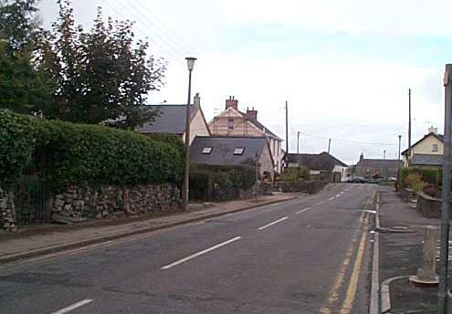
The present appearance of the village is of a mixture of housing styles. Cottages and smaller farmsteads in vernacular style and small houses of late nineteenth to early twentieth century type predominate in the original centres, with houses of successive later twentieth century type extending along the roads between them and in limited areas of infill (Evans 2003a Landmap H16 Bishopston (SWNSHL957)).
A major detriment to the built landscape of Bishopston has been the loss of Backingston and Bishopston House. Backingston (01728w; 17984) was a very important house in terms of Gower vernacular architecture embodying all typical Gower features and originally of the three unit backing-on-entry house type of mid-sixteenth century or earlier date with hall between outer and heated inner rooms (RCAHMW 1988, 22). Bishopston House (02146w; 18033) associated with the Hancorne family (Lyle 1982, 22-34), but sadly demolished in the 1950s, was built in c.1600 and has eighteenth and early-nineteenth century additions. It is two-storey and displays characteristic Gower features such as the stairs rising over entry (RCAHMW 1988, 38).
From the sixteenth century lime burning was an important industry in the Gower, and was particularly significant in the eighteenth century era of agricultural improvement. Much of the lime was shipped to the south west of England, where it was used to improve the acid rich moorland soils. Gower limestone has high magnesium content, and was noted for ease of combustion with either wood or coal (Morgan (ed) 1980; Toft 1988b, 65-6).