Llancarfan
007 Middlehill Agricultural Area

HLCA 007 Middlehill Agricultural Area
Medieval/post medieval field system; dispersed settlement; agri-industrial features. Back to Map
Historic Background
The historic landscape area of Middlehill Agricultural Area represents an area of post-medieval agricultural landscape with surviving characteristic features. The area is to the east/northeast of the village of Llancarfan and located on an area of higher ground above the middle Llancarfan valley and Nant Llancarfan. Bounded to the west by a small tributary stream that runs into Ford Brook along the former line of Walterston hamlet boundary, the area is north of Castle Ditches hillfort. Much of the land within this character area is recorded on the 1840 tithe map as owned by Sir Thomas Aubrey and William Jenkins.
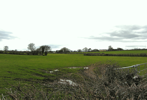
The main element to survive from at least the post-medieval period in a recognisable form is the area's field system, appearing now in an almost entirely unaltered state since it's mapping on the 1st edition OS map. The area also contains a number of fossilised quillets or medieval strip fields. These relict elements relate to the former medieval open field systems and are a key characteristic of this area.
Settlement in the area comprises two farmsteads, one at Pen-y-lan and a second at Middlehill. The farmstead at Middlehill is comparatively new not appearing in the cartographic record until the production of the modern OS map; Pen-y-lan however is much longer established at least by the survey of the 1st edition OS map in 1879.
Historic Landscape Characteristics
Middlehill Agricultural Area is characterised by a largely post-medieval agricultural landscape that consists of large enclosed fields recognisable in both regular and evolved forms. The surviving medieval field pattern is characterised by a mix of fossilised quillets or medieval strip fields and former open field systems, similar in character to elsewhere in the Llancarfan Historic Landscape. The characteristic field boundaries are hedgerows on low banks, and occasional distinctive trees.
Settlement in the character area is limited, with only two settlements identified within the area, the farmsteads at Middlehill and Pen-y-lan. The nature of settlement within the area could thus be characterised as dispersed, as is characteristic of the wider area as a whole. Middlehill is relatively new only appearing in modern mapping and is limited to a handful of agricultural and other domestic buildings but the settlement at Pen-y-lan though similar in nature has much earlier origins appearing in place before the survey of the 1st edition OS map of 1878.
Other minor characteristics relate to agricultural industry and extraction including features such as limekilns and small-scale quarries (PRNs 02634s; 02635s). It is likely that these features will have had a role in the development of the wider historic landscape as a whole providing materials for building via extraction and processing of limestone. The majority of these features are recorded in documentary and cartographic material, their current condition and state of survival is unknown.