
Transport and travel
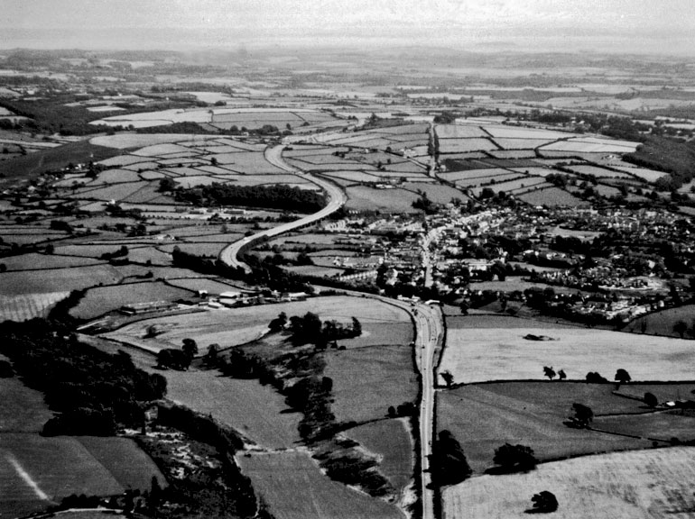
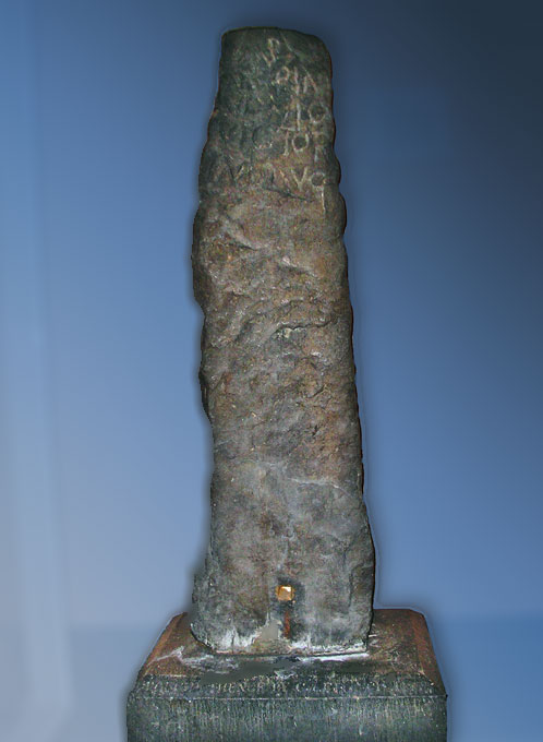
During the conquest, the army would have used existing roads and tracks, possibly ancient ridgeway routes, but roads would have been constructed fairly quickly to link the Roman forts. Two of the roads through our area are described in a 3rd century document called the Antonine Itinerary, a sort of Roman route planner. This gives one route from Carmarthen to Wroxeter via Nidum (Neath), Bomium (probably Cowbridge), Isca (Caerleon), Burrium (Usk) and Gobannium (Abergavenny). We can trace the approximate line of part of this road by a series of milestones that have been found between Neath and Pyle. Another route ran from Caerleon through Caerwent and across the Bristol Channel to Bath and Silchester.
Some Roman roads can still be recognised on the ground by the surveying and engineering techniques employed by the army. Roads were laid out in a series of straight lengths by surveyors sighting from one high point to another, but the exact course was determined in part by the lie of the land - for instance, rivers had to be crossed at points that were suitable for a bridge or ford. On hills Roman roads were set out with the needs of a marching army in mind rather than carriages, and the engineers are likely to have climbed steep slopes with short lengths of road changing direction with hairpin bends. Other typical engineering features are embankments and cuttings or terraces, A Roman road embankment is known to archaeologists by its Roman name of agger. It sometimes had side ditches for drainage, or ‘borrow pits’ dug either side to obtain stones for metalling.
Some roads have remained in use continuously since the Roman period. However, we should not expect to find them complete with their Roman surfaces, since they would have been made up many times in the intervening centuries. Where Roman road surfaces have been identified, it is because the road went out of use and was buried. The Trust has excavated a number of these. Typically, the road foundation was constructed from a layer of large stones, and then layers of smaller stones were added over the top to form a good surface, which would often be cambered to throw off the water. Where there was heavy wear, for example as the road left a fort or passed through a settlement, the Romans might have resurfaced it a number of times.
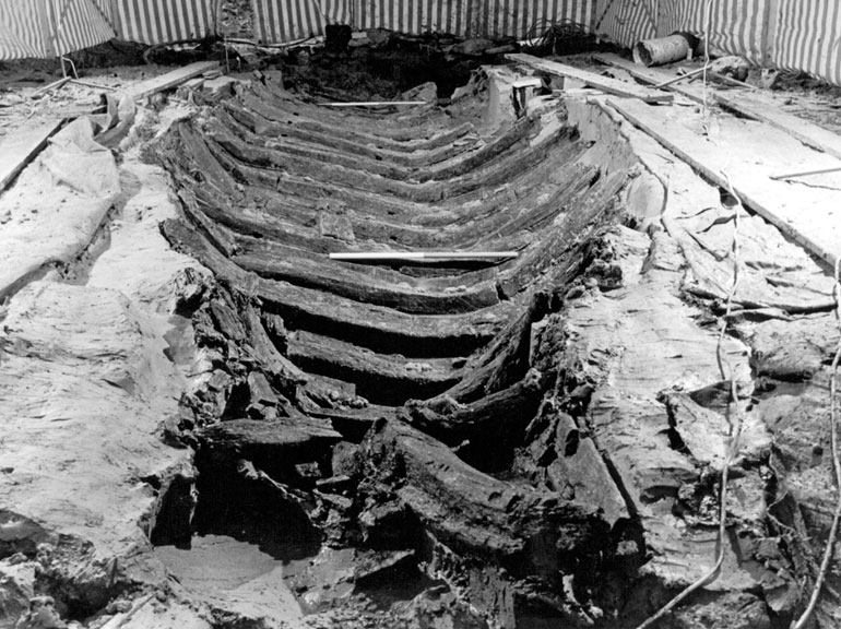
Another 3rd century document, fixing prices for goods and services, shows that it was much cheaper to send heavy or bulky goods by water. At Barland’s Farm near Newport, the Trust excavated a Roman boat that would have been able to sail the Bristol Channel, and the main rivers were probably also used to transport supplies. In the 1960s a quay was excavated on the edge of the River Usk at Caerleon. Part of the makeup for the surface was stone that had come from the Presceli hills in West Wales, probably as ballast.