Lower Wye Valley
006 The Kymin

HLCA 006 The Kymin
Possible encroachment settlement (ie squatter origins): irregular scatter (cottages within small irregular enclosures); communication features; traditional boundaries; broad-leafed woodland and scrub. Back to map
Historic Background
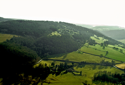
The historic landscape area of The Kymin comprises a discrete area of scattered settlement located within deciduous woodland on a west-facing precipitous hillside to the east of Monmouth within the parish of Dixton Newton. The area forms the essential setting of the adjacent Kymin Naval Temple, a registered park and garden (see HLCA 031).
The earliest evidence for activity at the Kymin is represented by a potential hillfort of Iron Age date, the curvilinear boundary of the site tentatively identified on historic mapping, though a recent visit failed to locate the site (Wiggins 2006).
It is unknown whether the known post-medieval settlement of the area has earlier origins; however the settlement's location on land likely to have been former common during the medieval period suggests its origins lie in early post-medieval encroachment, certainly the layout of the settlement is indicative of a squatter type settlement. The Dixton tithe map of 1844 and later mapping show the irregular nature of the settlement; a scatter of cottages within a matrix of small enclosures and much of the land here is recorded in the ownership of the Duke of Beaufort during the mid-nineteenth century. Further investigation of the settlement's origin is required.
Historic Landscape Characteristics
The Kymin is characterised by its settlement, a scatter of bungalows and nineteenth century cottages set within small irregular enclosures and woodland. The settlement's scattered haphazard layout of the smallholdings on steep marginal land is indicative of a 'squatter' or encroachment landscape.
Whilst some traces of nineteenth century cottages remain visible beneath much twentieth century remodelling and additions, bungalows now make up the dominant building type. The original settlement comprised small cottages associated with individual plots (as depicted on the tithe map of 1844). The most densely settled part of the settlement lies at the north of the area on the northwest-facing slope. Whilst the outer boundary of the enclosure area is irregular, the small enclosures appear to have a rectilinear shape, possibly dictated by the steep gradient of the topography in the area. This area is transected by a network of small winding though almost parallel lanes accessing the settlement area and the higher ground of the Kymin to the east.
To the south is an area of less densely settled slightly larger enclosures on less precipitous west-facing slopes; here the enclosure form is slightly more irregular in plan. The exact relationship between the morphology of the settlement and its chronological development might benefit from further investigation. A range of building forms exist, at least in terms of ground plan; the tithe map and the First Edition OS map show the cottage layouts as mostly rectangular or square, though recent additions have often altered the original form. These cottages are generally constructed from stone, which has been rendered; the roofing material is predominantly slate.
A network of minor winding lanes and paths (including a section of the Offa's Dyke long distance path) is also characteristic of the area. These enclosed sinuous pathways or lanes importantly provided access to the various holdings of the settlement and linked the area to the surrounding hinterland, as well as the settlements at Upper Redbrook, Wyesham and Monmouth, and nearby woodlands, eg, Beaulieu Wood to the northeast. The lanes were made largely redundant with the construction of the Kymin Road, the main communication feature within the area. The latter is the 'fine carriage road' commissioned by the Duchess of Beaufort in c.1800, to provide access to the Naval Temple and the adjacent Round House (HLCA 031).
The woodland or semi-wooded nature of the enclosed landscape is also characteristic; the area is today dominated by a mixture of deciduous broadleaf, scrub and unmanaged scrub woodland. The wooded nature of the enclosure at the Kymin could either be the result of piecemeal encroachment, with irregular enclosures won from surrounding woodland, or perhaps simply be the result of lengthy reversion to scrub, as the dependency on smallholding and corresponding land use has declined from the nineteenth century.
Traditional boundaries are an important characteristic of the area, and include a variety of dry-stone walls, hedges (both laid and un-laid), stone-revetted earth banks, augmented more recently by post and wire fencing.
Other minor characteristics that add to the character of this area potentially include that of the relict prehistoric settlement/defensive element provided by the potential site of the prehistoric hillfort, the location of which straddles the border with the adjacent area (HLCA 031).