Historic Landscape
Characterisation
The Rhondda
029 Rhondda Fawr: Enclosed Valley Sides
HLCA 029 Rhondda Fawr
Largely relict medieval/post-medieval agricultural landscape; distinctive
field boundaries; prehistoric funerary landscape and settlement; upland
medieval agriculture and settlement; post-medieval agriculture and farmsteads
(predominantly longhouse regional types); documentary evidence for both
medieval/post-medieval agricultural practice and settlement; extensive
industrial landscape with features dating from the early phases of mineral
extraction.
Click here for character
area map
(Back to map)
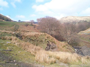
The historic landscape area of Rhondda Fawr: Enclosed Valley Sides is a landscape of some importance, a palimpsest of surviving archaeological features of considerable time-depth, and variety, indicating development and change of use over the last 12000 years. The earliest indications of human settlement of the landscape are the Mesolithic (10000-4400BC) sites at Fforch above Cwmparc, Cefn Glas, and Mynydd Ystradffernol, where flint assemblages and stray finds have been recorded. Similar finds from the area are dated stylistically to the Neolithic (4400-2300BC), including a number of flint arrowheads and other finds often associated with charcoal from Mynydd Ystradffernol and Tarren Pantyffin and the find of a Petit tranchet axehead from the slopes of Mynydd Ynysfelo. Flint processing is also recorded on Mynydd Ty-newydd. The Bronze Age (2300-800BC) is represented by finds of a bronze tanged spearhead with ribbed blade from Blaenrhondda and a cairn field at Blaenrhondda.
Though no Iron Age/Romano-British settlements are known for the area itself, settlement of the period is known from adjacent areas. Numerous hafodau and platform house sites located on the upper slopes of the area indicate far more extensive and significant settlement during the medieval period. Sites of the period include platform houses on Mynydd Ty'n-tyle and longhut settlements in Cwm and Nant Saerbren. Hafodau, or seasonal upland agricultural dwellings are known at Cwm-y-fforch, Mynydd Ynysfeio, at Garreg Lwyd, Blaenrhondda, and in Blaenycwm, while another unspecified medieval settlement site exists at Penrhiw Castell Llaeth. Areas of medieval settlement are also indicated by place-name evidence, with the survival of hafod and hendre names, which also illustrate medieval agricultural and administrative practices; Coedcae field names indicate medieval encroachment on the waste or woodland of the area. The name Bodrhyngallt, as in Cwm Bodrhyngallt and in the name of the post-medieval farmstead may indicate the settlement of a Rhyngyll, a medieval Welsh official (chancellor) known from the Medieval Laws to be associated with the administrative system of the native Welsh rulers.
The best surviving example in the Rhondda of the once typical regional farmhouse type, the longhouse or ty-hir, Ty'n-tyle probably dates to the early 17th century; it is of two and a half storeys, retaining a central hearth and original doorway to raised passage between hall and cowhouse, though a new entrance with porch has been made directly into the hall. This farmhouse, set in an excavated hollow at right angles to the slope of the hillside, is typical of the design of longhouses: an entrance, to the side of the central chimney, is provided directly between the byre, at a lower level, and the living accommodation; the original external entrance being via the byre (three-unit longhouse with hall between narrow inner room and cowhouse; hearth-passage group: longhouses with raised passage, RCAHMW). A tradition exists of the beams at Ty'n-tyle originating from the nearby Cistercian Grange of Penrhys. A variation of the longhouse type can be seen at Bodringallt (Bodrhyngallt), another 17th century building, characterised by a direct entry at the centre of the house and no central chimney (Direct-entry group: end-chimney house, RCAHMW). Fforch-Orchy is a modernised 3-unit lobby-entry house. An exception is Ty-draw, which has been classified as belonging to the miscellaneous group (RCAHMW).
The agricultural landscape is dominated by small and medium sized irregular fields, where the gradient of the hillsides allow, numerous sheepfolds survive, in particular at Garreg Lwyd and Blaenrhondda. Cartographic evidence indicates other post-medieval agricultural features in the area such as beast houses, cattle or sheep shelters and temporary upland dwellings, i.e. lluestai. Coedcae field names and charcoal burning sites at Blaenrhondda and Cwm Bodrhyngallt, and pockets of surviving regenerated ancient woodland, illustrate the formerly wooded nature of much of the area during the pre-industrial period; a significant proportion of the area has seen modern forestation.
Several colliery sites, including Bodringallt, Lady Margaret, Nant-dyrys, and Tyle-coch, located within the boundaries of the area impinge on the character of the historic landscape. Additional, though minor, industrial sites, such as quarries, coal levels, airshafts, inclines, and tips, are superimposed upon and set within the remnants of the partly relict medieval/post-medieval agricultural landscape; of particular interest is the scheduled incline haulage system at Cefn Ynysfeio (SAM Gm508), which retains its drumhouse among other buildings. Numerous coal levels, trial levels and pits are typical of the slopes; these are particularly notable in Blaenrhondda, Blaenycwm, Cwm Saerbren, and above Penyrenglyn and Treorchy. Quarries proliferate throughout the area associated with the upsurge in house construction following 1850; a particularly fine example is located above Treherbert. Other features of the period include the tunnel of the former Rhondda and Swansea Bay Railway at Blaenycwm constructed in 1889.
