Historic Landscape
Characterisation
The Rhondda
023 Rhondda Fach:
Eastern Enclosed Valley Sides
HLCA 023 Rhondda Fach
Relict agricultural landscape to an extent modified by industrial development;
distinctive field boundaries; documentary evidence of medieval/post-medieval
agricultural practice and settlement; post-medieval upland settlement
(longhouses); industrial landscape associated with mineral extraction,
predominantly coal; ancient woodland and modern forestation.
Click here for character
area map
(Back to map)
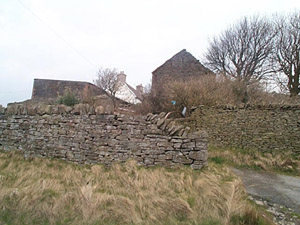
The historic landscape area of Rhondda Fach: Eastern Enclosed Valley Sides encompasses the surviving agricultural landscapes associated with the early post-medieval farmsteads east of the Afon Rhondda Fach and north of the Afon Rhondda south of Porth. The extent of post-medieval enclosure as indicated by the cartographical evidence, is still traceable on the ground, demarcated by drystone walls.
Surviving post-medieval farmsteads are a distinctive feature of the area, these include, Nant Dyris Ycha, Blaenllechau, Ty-newydd, Cefn-llechau-uchaf, Penyrheol, Llwyncelyn, Hafod Fach, Hafod Fawr, Hafod Ganol and Hafod Uchaf. Nant Dyris Ycha (Nant Dyrys-uchaf) a substantially altered longhouse is typical of the characteristic farmhouse type in the Rhondda during the 17th and 18th centuries, the longhouse or ty-hir, in which traditionally the farmer, his family, farm labourers and livestock all lived under one roof. These structures were usually arranged at right angles to the slope of the hillside, with a byre at the lower level, and living accommodation at the upper level often with a central hearth between and sharing a common entrance, usually via the byre. Blaenllechau is a three-unit longhouse with hall, heated inner room and cowhouse with raised passage, early 17th cent, altered 1761 (hearth-passage group: with raised passage, RCAHMW). Hafod Fach is a variation of this once typical regional farmhouse type, characterised by a direct entry at the centre of the house and no central chimney (direct-entry group: end-chimney house, RCAHMW). The farmstead at Cefn-llechau-uchaf is an exception, being a miscellaneous house type. The area also contains contemporary agricultural buildings, e.g. the 4-bay 18th century barn at Blaenllechau; and the 4-bay barn with extra bay forming cart shed, and the cattle shed at Hafod Fawr.
The 1st edition 6-inch OS map (1884, surveyed 1875) shows minor industrial development primarily coal and trial levels, while the landscape is predominantly characterised by a patchwork of small and medium sized irregular fields, largely unchanged from the earlier Tithe map of Llanwonno Parish (1841), with the lower, steeper slopes for the most part, densely covered by scrub woodland. Minor quarrying is noted from the publication of the 2nd edition OS map of 1900, as are the extensive workings of the National Colliery, Wattstown with its tramway/incline, by the 3rd edition quarries and a further substantial linear tramway/incline are in place above Ynyshir.
