Historic Landscape
Characterisation
The Rhondda
015 Blaenrhondda
HLCA 015 Blaenrhondda
Linear-planned, valley-head colliery settlement; 1st phase pithead settlement
with outlying isolated rows with 3rd phase additions; predominantly residential
in character with negligible commercial development; homogeneous visual
aspect, while illustrating developments within a formative colliery settlement;
retains distinct village identity separate from neighbouring settlements;
good examples of typical terraced colliery housing and associated chapels
and schools; reclaimed Fernhill Colliery site.
Click here for character
area map
(Back to map)
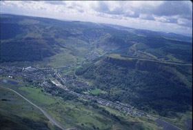
The historic landscape area of Blaenrhondda encompasses a colliery settlement of the 1860s, and site of the former associated collieries erected on the land of Blaenrhondda and Ystradffernol farms, both part of the Dunraven Estate (Tithe map and schedule of Ystradyfodwg, 1844). The initial impetus for the settlement was the sinking of two collieries, Blaenrhondda and Fernhill collieries. Blaenrhondda Colliery, also known as the North Dunraven Pit, was sunk in 1859 by George Lockett, James Marychurch, Herbert Kirkhouse and Rees Jones and traded as the Cardiff and Merthyr Steam Coal Company until bought as a going concern by the London and South Wales Coal Company in 1875. In the meantime development of the adjacent Fernhill Colliery started with the sinking of Nos. 1 and 2 pits by J. Marychurch and Partners in 1871. Pits Nos. 3 and 4, Fernhill, were sunk under the ownership of Messrs Crowley, John and Oldroyd of Dewsbury further in 1872. Blaenrhondda and Fernhill collieries were amalgamated in 1893 under the ownership of George Watkinson and Sons to form Fernhill Collieries Limited. The concern closed in 1966, and the site was subsequently subjected to reclamation after a short-lived development as a Wild West theme park.
The settlement appears to have been constructed in a relatively short period, its linear ribbon plan along Brook Street, paralleling the Blaenrhondda Branch of the Taff Vale Railway (1859), which leads to the collieries and Blaenrhondda Brickworks, clearly established by the survey of the 1st edition OS 6-inch map in 1875. Also shown are the outlying terraced 'rows' or huts (wooden huts provided by the colliery owners for workers involved in the initial shaft sinking, often used for much longer periods than initially intended and usually plagued by unsanitary conditions), seven in all, including the later named Caroline Street, north of the Blaenrhondda Colliery site, Blaenrhondda Farm and chapel, and Fernhill Cottages south of Fernhill Colliery. By the publication of the second edition of 1900 (revised 1874-75), Brook Street is shown complete with chapels (Capel Bethesda, Methodist and Baptist), hotel and school (now disused), while the area of housing or huts near Blaenrhondda Colliery has been substantially reduced. Craig-yr-Hesg Tramway is also depicted, while allotments on the slopes above the housing become a prominent feature of the settlement landscape for the first time. The 1921 edition (revised 1914) shows both collieries, extended as the Fernhill Collieries, the settlement of Blaenrhondda now has an Institute, a public house, the Tabernacle chapel and an enlarged school, while Brook Street has been extended further south on the east side and Clyngwyn Road and Blaenrhondda Road built. An extra terrace has also been constructed over the yards at the rear of Caroline Street. Little obvious change occurs by the publication of the OS 6-inch Provisional edition of 1948.
