Historic Landscape
Characterisation
The Rhondda
004 Williamstown
HLCA 004 Williamstown
Minor first phase colliery settlement, later 2nd and 3rd phase
expansion; ribbon development settlement and late 19th century imposed
grid-layout; retains typical terraced housing, commercial properties and
chapels; residential colliery village with low urban morphological and
functional development.
Click here for character
map area
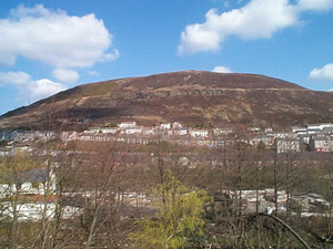
The historic landscape area of Williamstown comprises an industrial settlement constructed on the southern part of Dinas Uchaf Farm from the latter half of the 19th century. Dinas Uchaf Farm, in the parish of Llantrisant was at the time part of the estate of Walter Coffin, the pioneering coal entrepreneur. The initial development is a small, dispersed, ribbon settlement of houses named Alma Terrace (1st edition 6-inch OS map, 1885, surveyed 1875). However by 1898, the settlement has changed radically; development is well underway and the settlement has expanded beyond the initial roadside terraces along Cornwall road producing a regular grid layout of terraced houses, including Arthur Street, Rowling Street, Caroline Street, and School Street. This development is dependant largely on the success of nearby collieries, i.e. Ely, Dinas-isaf Pen-rhiw-fer and Penygraig Collieries. The Dinas-isaf and Pen-rhiw-fer collieries both lie outside the Rhondda Special Historic Landscape Area. Like the neighbouring HLCA 003 Penygraig, the area is strongly associated with the activities of Moses Rowlands, who in partnership with Richard Jenkins developed the Penygraig Level in 1857/8. Rowlands and Jenkins, later in partnership with William Morgan, William Williams (after whom the settlement is named) and John Crockett formed the Penygraig Coal Company, which in 1864 sunk the Penygraig Colliery. Six years later the colliery had an annual output of c. 100,00 tons, the mine closed in 1919. The Ely Colliery is depicted, but not named on the first edition OS map and is obviously in operation before the major settlement development takes place at Williamstown. The Ely Pit of the New Naval Colliery Company, later part of the Cambrian Combine (1908), was sunk in 1892. In 1910 it employed 939 men and was the scene of the start of a bitter dispute, which rocked the South Wales Coal Field for many years. The colliery continued to operate until 1928 after which the pit was used for pumping purposes until its closure in 1958. The development of Williamstown was rapid during the closing years of the 19th century and by the outbreak of World War One it appears largely as it is today (1921 edition 6-inch OS map revised in 1914/15).
