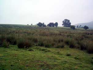
Historic Landscape
Characterisation
Merthyr Tydfil
075 Garth Fawr Improved Common
HLCA 75 Garth Fawr Improved Common Area characterised as improved and enclosed common land, regular large enclosure of recent date; place-name evidence.
Summary
An area of improved and enclosed common land characterise by regular large enclosures of resent date.
Historical background
The historic landscape area of Garth Fawr Improved Common is an area of common which was the subject of agricultural improvements, ie stone clearance and drainage works, during the mid-20th century. Cartographic evidence show the area lay originally outside the area of enclosed land. Earlier place-names 'Cairn-mawr' (great cairn) in 1875 and later Garth Fawr (great enclosure), suggestive of prehistoric burial monuments or enclosures, possibly refer to the nearby settlement west of the area within the HLCA 033, but might equally refer to the earlier rocky nature of the un-cleared common.
