Historic Landscape
Characterisation
Merthyr Tydfil
066 Waun-y-Nant Goy Tips
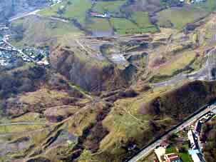
HLCA 66 Waun-y-Nant Goy Tips Industrial extractive, waste tipping and processing landscape associated with Cyfarthfa Ironworks; industrial transport corridor.
Click here for a
character area map
Summary
An industrial landscape associated with the Cyfartha Iron Works, primarily characterised by extensive waste tipping.
Historical background
The historic landscape area of Waun-y-Nant Goy Tips was part of the Dynevor Estate, leased during the first half of the 19th century by William Crawshay for the purpose of tipping. Between 1814 and 1826 extensive tips were being created above Gellideg from tipping lines connected to the Mynydd Aberdare-Cyfarthfa Tramroad within the area of the Waun, greater detail is provided by the 1st edition 6-inch OS map of 1875. In addition to the extensive tips, the area contained numerous industrial extractive features, part of the more extensive system of Cyfarthfa Mines. These were primarily iron ore levels, such as Gellideg Level, Jenkins Level, I Jenkins Level, and Middle Level, though at least one coal level and an airshaft were also present in the area (6-inch OS maps 1875, 1905 and 1915). Pen-yr-heolgerrig Quarry was active before 1875, and does not appear to have seen much use thereafter. The industrial tramroads serving workings to the west of the area are largely in place by 1814, and detailed on the surveyor's drawing of 1826 and the 1st edition 6-inch OS map of 1875. These include the Mynydd Aberdare - Cyfarthfa Tramroad, the Cwm-glo - Cyfarthfa Tramroad, and the Pen-yr-heol-gerrig Tramroad among others, the tramroads of the area were apparently long-lived and several remained under track until after 1915.
