Historic Landscape
Characterisation
Merthyr Tydfil
041 Merthyr Common, North
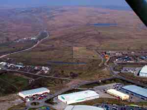
HLCA 41 Merthyr Common, North Common land, water management features (Dowlais Free Drainage and Merthyr Tydfil Corporation); minor industrial extractive landscape.
Summary
An area of common land containing characteristic water-management features,
including part of the 19th century Dowlais Free Drainage System associated
with the Dowlais and later the Ivor Iron Works; individual components
include the Saints and Pitwellt Ponds and numerous associated features.
Historical background
The historic landscape area of Merthyr Common, North comprises an area of traditionally open mountain grazing, part of the extensive Merthyr Common east of Twynau-gwynion Quarries and its associated limestone railway. The area's characteristics extend beyond the eastern boundary of the Merthyr Tydfil and the historic landscape. The watershed of the area dissected by various natural watercourses such as Nantmorlais and Torgwyn, has been subsequently exploited for water management purposes: the area contains the most northerly part of the Dowlais Free Drainage System, a system of reservoirs and leats, which evolved over a period of over 70 years to serve the Dowlais Ironworks and associated workings.
The area contains Pitwellt Pond, shown on the 1850 tithe map, known to have been complete by 1862. The other reservoir in the area is the Saints Pond, which had been added by 1891. Pitweld (Pitwellt) Pond is shown as drained and 'disused' on the 1919 OS map, but is described as in use in Dowlais documents of 1920.
In addition to these industrial features, the area has a reservoir built by the Merthyr Tydfil Corporation in c 1902 as part of sanitation improvements; other features are mainly stone quarries.
