Historic Landscape
Characterisation
Merthyr Tydfil
030 Pantcadifor, Rhyd-y-Bedd and Caeracca
HLCA 030 Pantcadifor, Rhyd-y-Bedd and Caeracca Minor industrial
settlement: early ribbon development with later regular terraces; major
cemetery; transport corridor (railway); historic associations
Click here for a
character area map
Summary
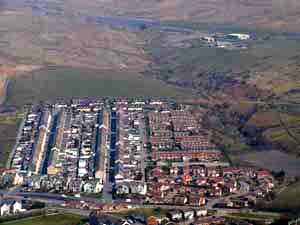
A roadside settlement of late 18th century to early 19th century and later date, associated with local quarries. The settlement, which now also contains 20th century social housing and executive housing, is dominated by its mid 19th century cemetery with two chapels.
Historical background
The historic landscape area of Pantcadifor, Rhyd-y-bedd and Caeracca originated as a small roadside quarrymen's settlement. By the 1870s, the settlement had grown to the north and south eventually merging with Dowlais. The original settlement at Pant appears in 1799 as a small settlement at the junction of the Penydarren and Dowlais roads to Brecon, nucleated around the Pant-Cad-lvor Inn (c 1740), with minor development along the road south to Nant Morlais (Dingle) and Dowlais, including the farms of Cae'r-acca and Cwm Rhyd-y-bedd. By 1814 a small settlement was in place at Pantysgallog, including Pantysgallog House, just to the south of the original settlement at Pantcadifor, while to the west was a row of cottages (Tair Efail on the 1850 Tithe Map).
The settlement remained static during the period up to 1850, apart from a major shift in the alignment of Pant Road to the south, and the establishment in 1849 of the prominent cemetery for victims of the second cholera epidemic to hit Merthyr (the first being in 1832). Pant Cemetery with its two mortuary chapels, one nonconformist, one Church of England, was located on land formerly part of Castle Farm.
The Dowlais Fever Hospital located slightly to the south of Pantysgallog had been constructed in 1869 for the Merthyr Board of Health, built of wood, this 32 bed hospital was occupied on a temporary basis during epidemics. Just northeast of Pant Road was the Dowlais Branch of the Brecon & Merthyr Railway, built in 1864/65, with a signal box.
The settlement developed in ribbon fashion with roadside developments of industrial workers' rows constructed at Pantysgallog and at Pant-Cerddinen to the south of Bryniau Quarry by 1875. Forty years later, the settlement had grown to include King and Queen Streets in the area between Pant Road and the Merthyr Extension of the LNWR (c 1868). Additional terraces had been constructed on the west side of Pant Road (New Houses), while a new area had been established to the east of the Brecon & Merthyr Railway including Caracas Terrace, and the grid layout of Edward and Gwladys Streets. By this date the settlement, served by a halt on the BM Railway and a station on the LNWR, also boasted schools, a post office, and a church, Christ Church, a laundry.
