Historic Landscape
Characterisation
Merthyr Tydfil
026 Cilfach-yr-Encil
HLCA 026 Cilfach-yr-Encil Surviving area of pre-industrial
evolved irregular small agricultural enclosures with little industrial
influence.
Click here for a
character area map
Summary
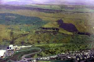
An agricultural landscape characterised by evolved irregular enclosures, representing post-medieval encroachments of the upper valley sides.
Historical background
The historic landscape area of Cilfach-yr-encil is a small but discrete area of evolved but regular rectangular and sub-rectangular enclosures located on the less precipitous shoulder of the hill, above the valley bottom. The area represents post-medieval encroachment complete by the 1820s. The holding and farmstead appears on maps from 1826 onwards, though the holding is probably earlier in date, possibly dating to the hiatus in upland agriculture experienced as a result of the Napoleonic Wars. The farm was the property of a John Llewellyn and Mrs Ann Robert during the mid-19th century. The field pattern of the area remained largely unchanged except for minor sub-division. By the early 1960s, if not earlier the farmstead of Gilfach-yr-encil had been abandoned.
