Historic Landscape
Characterisation
Merthyr Tydfil
025 Nantyrodyn and Bwllfa Workings
HLCA 025 Nantyrodyn and Bwllfa Workings Minor post-medieval
enclosure and settlement (ruinous); extractive industrial landscape: trial
and coal levels; agricultural/industrial tracks/possible tramway and incline
corridor; Ancient Woodland
Click here for a
character area map
Summary
An industrial landscape comprising extractive features dating to the second half of the 19th century and associated with the Plymouth Iron Company. Industrial remains include coal workings, a quarry, inclines and a winding-drum. There are also relict areas of former waste and woodland which has been enclosed, and small-scale post-medieval encroachment.
Historical background
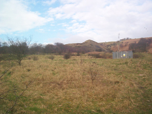
The historic landscape area of Nantyrodyn and the Bwllfa Workings comprised an extensively wooded southwest facing enclosed area of poor agricultural land known as the Graig with at its lower western edge an area of post-medieval encroachment adjacent to the track, which connects the settlement of Dyffryn with the open mountain. The name Nant-yr-Odyn would appear to indicate a kiln site in the vicinity. The encroachment, represented by two cottages and gardens at either end of an elongate enclosed meadow with arable further down slope to the west, was charted on maps of 1813, 1826 and 1832. By 1850, both cottages are the property of one Thomas Thomas and the higher one is named as Bulca (Balka, 1875: Bwllfa). More detail was provided by the 1875 OS map, which showed a further small holding Nant-yr-Odyn, comprising a cottage with a small arable plot and two nearby wells near the head of the Nant-yr-Odyn stream valley. Despite enclosure and limited drainage, the area maintained its appearance as mixed woodland and rough grazing, though by the early 1960s the holdings of the area have all been abandoned.
The area appears to have seen some level of industrial exploitation from the early part of the 19th century, with features visible in 1826. The area was leased in 1850 to Anthony Hill owner of the Plymouth Ironworks. Between 1850 and 1875, the area changed dramatically; a major incline, in two sections, has been constructed along the northeast boundary of the area. This feature connected coal levels on Mynydd Cilfach-yr-encil with the coke ovens to the north east of the Dyffryn Furnaces; and served additional ironstone and coal levels along its length. An engine house was located at the top of the lower section of the incline at this date. Another feature of interest. Troed-y-rhiw Quarry', was served by an incline, which zigzagged down to Dyffryn Row and the Dyffryn ironworks site. Other features included numerous tracks (or tramroads), which traversed the area around Balka (Bwllfa), minor drainage works and a number of minor industrial features; a trial shaft, a coal level and airshaft.
By 1901 the levels of the area were disused and the associated incline is described as 'old'; while a new incline direct to the South Dyffryn Pits, had replaced the earlier quarry incline.
The major aspect of the following period leading up to 1915 was a renewal of coal extraction brought on by World War One. A new incline was constructed during this period between one of the Bwllfa levels and the mineral railway serving the Graig (No. 2) and the South Dyffryn Pits, while an additional level and airshaft were in evidence in the area south and east of the Balca cottage. During the following period the Bwllfa levels were expanded with the creation of substantial tips, dominant visual characteristics features above Pentrebach. A coal level to the south of the Troed-y-rhiw, periodically worked from at least the mid 1870s, showed evidence of being reworked during the period; the level, like that at Bwllfa, was connected by incline to the mineral line of the South Dyffryn Pits.
